As scientists and meteorologists closely monitor the Atlantic Ocean, a tropical wave is gaining attention as it may evolve into Tropical Storm Ernesto. This developing weather system could have significant implications for coastal regions and the Atlantic hurricane season as a whole.
What Is Happening With the Tropical Wave?
What does the development of a tropical wave in the Atlantic Ocean mean for potential tropical storm Ernesto?
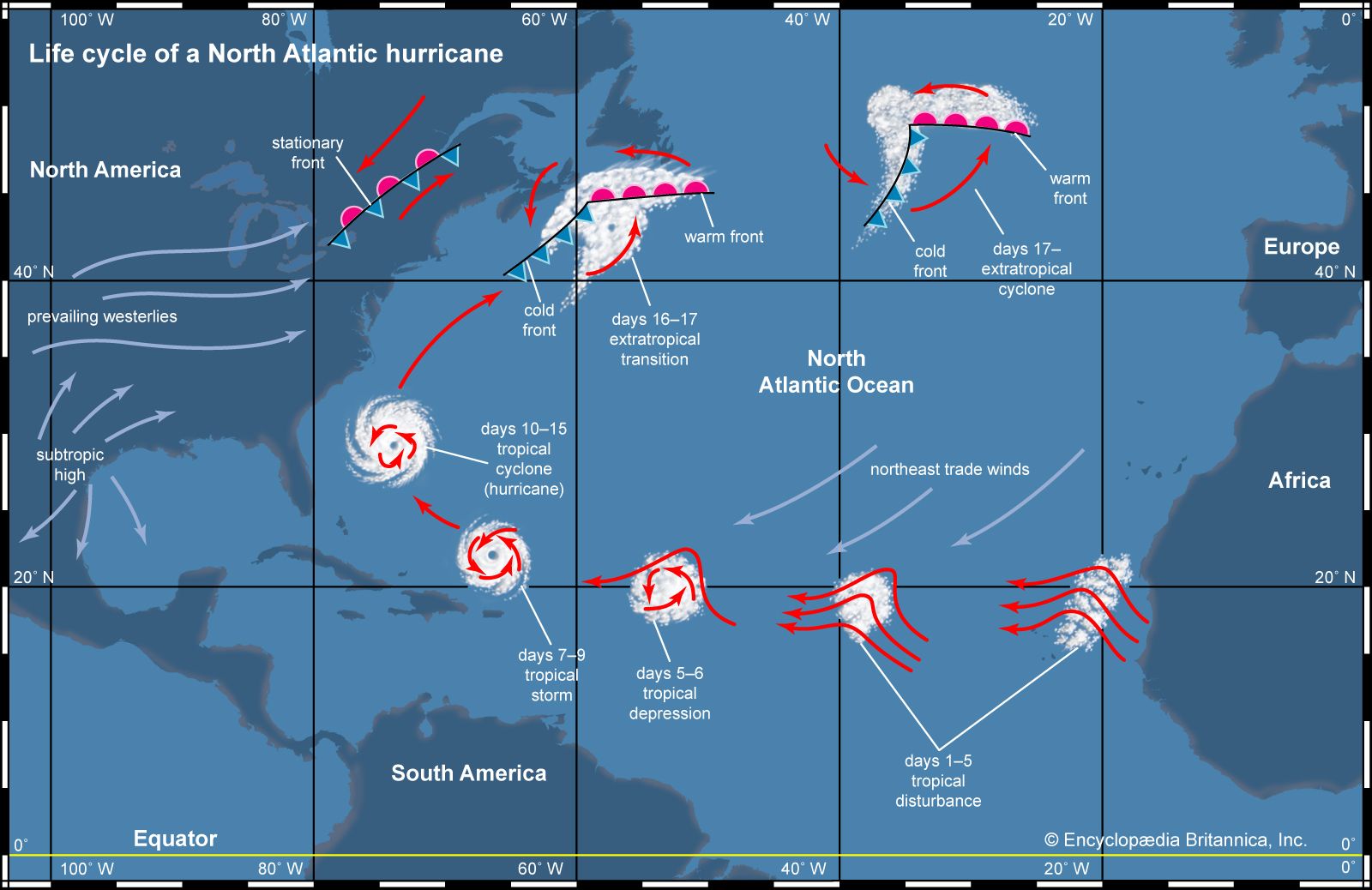
A tropical wave is a long, low-pressure area that can spawn thunderstorms and potentially develop into a tropical cyclone. As this wave moves through the Atlantic, conditions are becoming favorable for it to strengthen, which may lead to the formation of Tropical Storm Ernesto. Current forecasts suggest that atmospheric conditions, including warm sea surface temperatures and light winds aloft, could fuel this development.
Current Status of the Tropical Wave
According to the National Hurricane Center (NHC), the tropical wave is located approximately 1,200 miles east of the Lesser Antilles. Meteorologists report that the wave is producing a cluster of thunderstorms with some potential for development. As of the latest update, the system has a 40% chance of becoming a tropical cyclone within the next five days.
Key Meteorological Data
| Parameter | Value |
|---|---|
| Location | Eastern Atlantic |
| Distance from Lesser Antilles | 1,200 miles |
| Chance of Development | 40% (next 5 days) |
| Expected Path | Westward towards the Caribbean |
| Sea Surface Temperature | 80°F (27°C) |
The average sea surface temperature in the region currently stands at 80°F (27°C), which is conducive for tropical development. Additionally, forecasters predict that wind shear will remain low for the next few days, further increasing the likelihood of development.
Potential Impact of Tropical Storm Ernesto
Should this tropical wave strengthen into Tropical Storm Ernesto, it could pose several risks, especially for countries in the Caribbean and along the Southeast U.S. coast.
Projected Path and Forecast
Currently, meteorologists project that if the system continues to organize, it could take a path similar to other tropical systems, moving westward toward the Caribbean. Computer models show a varied range of potential outcomes, but the consensus indicates a trajectory that may bring it near the Greater Antilles within a week.
Forecast Models Overview
| Model | Projected Path | Intensity Forecast |
|---|---|---|
| GFS | Westward toward Caribbean | Possible Tropical Storm |
| ECMWF | Similar westward path | Tropical Storm strength |
| UKMET | Divergent, slight north | Weakening expected |
Safety Precautions
As Tropical Storm Ernesto could bring heavy rainfall, strong winds, and potential flooding, residents in the projected path should remain vigilant. Authorities recommend:
- Staying informed about weather updates from local meteorological services.
- Preparing emergency kits, including food, water, and necessary medications.
- Ensuring that homes are secure, especially in flood-prone areas.
Historical Context
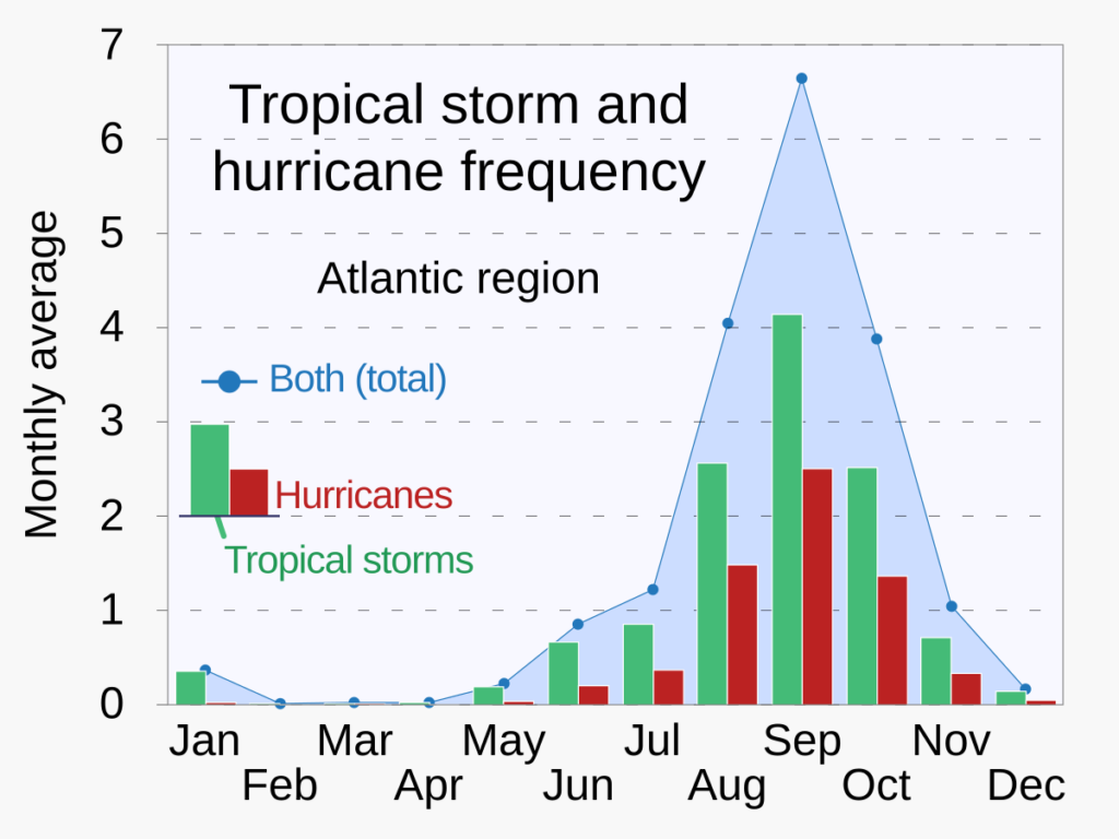
The development of Tropical Storm Ernesto adds to a historical pattern observed during the Atlantic hurricane season. Over the past decade, early-season systems have shown a tendency to strengthen quickly, emphasizing the need for early preparation.
Historical Storm Data
| Year | Storm Name | Maximum Wind Speed | Category | Date Formed |
|---|---|---|---|---|
| 2022 | Bonnie | 60 mph | Tropical Storm | July 1 |
| 2021 | Elsa | 75 mph | Category 1 | July 6 |
| 2020 | Isaias | 75 mph | Category 1 | July 29 |
The data reveals that several significant storms have formed in July, underscoring the importance of monitoring atmospheric conditions and staying prepared during this critical period.

Conclusion
As the tropical wave develops in the Atlantic Ocean, it has the potential to evolve into Tropical Storm Ernesto. With a current chance of 40% for development and favorable conditions, both residents and meteorologists are watching closely. Preparations and awareness will be crucial in minimizing risks for those in the projected path. Continued updates from the National Hurricane Center will provide critical information regarding the future of this system.
As the Atlantic hurricane season progresses, the monitoring of such weather systems emphasizes the importance of preparedness and timely response in the face of potential storms. Stay informed and stay safe.


