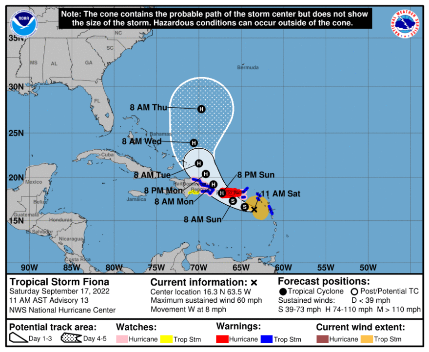
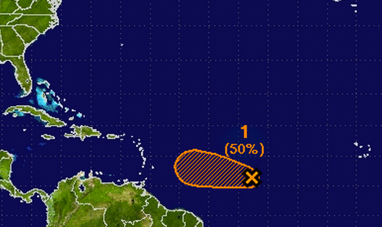
The National Hurricane Center (NHC) is currently analyzing a disturbance located in the Atlantic Ocean that shows potential for development into a significant weather event. This report aims to provide comprehensive insights into the status of this disturbance, including its projected path, expected intensity, and the implications it may have for coastal regions.
What is the National Hurricane Center monitoring?
The National Hurricane Center is monitoring a tropical disturbance in the Atlantic that could develop into a tropical depression or storm in the coming days. Current data suggests there is a 60% chance of cyclonic development within the next 48 hours.
Overview of the Disturbance
The NHC reported that the disturbance, located approximately 800 miles east of the Lesser Antilles, is characterized by disorganized showers and thunderstorms. Despite its current state, environmental conditions appear conducive for further development. The system is expected to move westward at around 15 mph, bringing it closer to the Caribbean islands.
Recent satellite imagery has captured the evolution of this system, revealing a broad area of low pressure. Meteorologists are closely monitoring this development, particularly because conditions in the Atlantic are generally favorable for systems to strengthen this time of year.
Current Conditions
As of the latest advisories, the NHC provides specific information regarding the disturbance. Here are key details:
| Parameter | Current Status |
|---|---|
| Location | 800 miles east of the Lesser Antilles |
| Movement | Westward at 15 mph |
| Chance of Development | 60% within 48 hours |
| Wind Speed | Variable, with some gusts |
| Atmospheric Pressure | 1009 mb |
Potential Impacts of the Disturbance
The potential impacts of this system vary depending on its development and trajectory. If the disturbance strengthens into a tropical storm, it may bring heavy rainfall, strong winds, and rough seas to the Lesser Antilles. Below are some anticipated effects:
- Heavy Rainfall: Localized flooding could occur, particularly in low-lying areas.
- Wind Damage: Sustained winds exceeding 39 mph can lead to downed trees and power lines.
- Storm Surge: Coastal areas may experience higher-than-normal tides, leading to flooding in vulnerable areas.
Historical Context
This time of year marks the peak of the Atlantic hurricane season, which typically runs from June 1 to November 30. Historical data shows that many storms form in the open Atlantic during September and October. Here’s a breakdown of notable storms that have formed during this period in past years:
| Year | Storm Name | Date Formed | Max Wind Speed (mph) | Impact |
|---|---|---|---|---|
| 2017 | Hurricane Maria | September 16 | 175 | Severe damage to Puerto Rico |
| 2018 | Hurricane Florence | September 10 | 140 | Major flooding in Carolinas |
| 2020 | Hurricane Delta | October 6 | 130 | Landfall in Louisiana |
Forecasting the Disturbance
Meteorological models currently indicate a variety of potential paths for the disturbance. The NHC uses various models to predict movement and intensity, including the European Centre for Medium-Range Weather Forecasts (ECMWF) and the Global Forecast System (GFS). The consensus among these models suggests a westward movement, possibly impacting the Bahamas and southeastern United States if development occurs.

Precautionary Measures
As the NHC continues to monitor the disturbance, it is essential for residents in coastal regions to remain vigilant. Here are a few precautionary measures advised by the NHC:
-
Stay Informed: Regularly check updates from the NHC and local meteorological services.
-
Emergency Kits: Prepare emergency supplies, including food, water, medications, and flashlights.
-
Evacuation Routes: Familiarize yourself with evacuation routes and local emergency plans.
Preparedness is not only about physical readiness but also about learning from the experiences and insights of others. Initiatives like the Spotlight Series highlight the importance of individual stories and professional perspectives in shaping how communities and organizations respond to challenges, reminding us that resilience often starts with awareness and proactive planning.
Conclusion
The National Hurricane Center’s monitoring of the Atlantic disturbance reflects ongoing efforts to provide timely and accurate information regarding potential tropical systems. With a 60% chance of development in the coming days, residents along the southeastern U.S. and Caribbean islands should prepare accordingly. As the situation evolves, the NHC will provide updated forecasts and advisories to keep communities informed and safe.
In these critical hours, staying informed and prepared can make a significant difference in minimizing the impact of potential storms. As we look ahead, the next few days will be crucial in understanding the full extent of this disturbance and its possible impacts on affected areas.


